|
Heybridge Basin (Cannibal
Island) |
|
|
Click
on underlined blue names for link to more details |
|
|
The Village tour |
|
Page
Eight |
|
|
|
The final part of this tour
is along the Village waterfront from 'Herrings Point' at the
South end to the Blackwater Sailing Club at the North end. |
 |
|
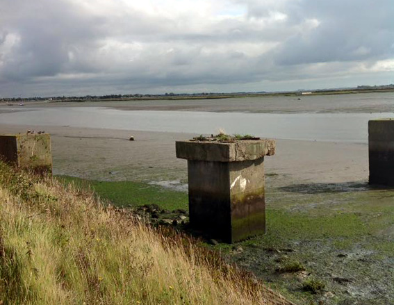
(above) all that remains of the sand and gravel business
operated by the 'Brush Company' at Herrings Point are these concrete
blocks that their crane was mounted on. |
|
|
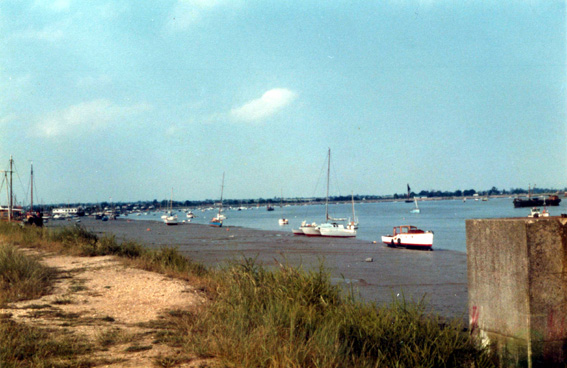
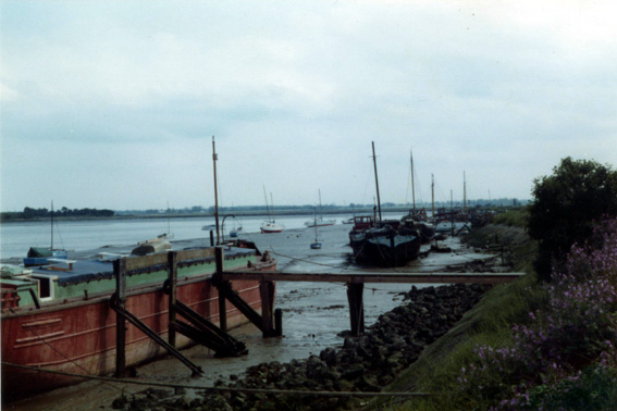
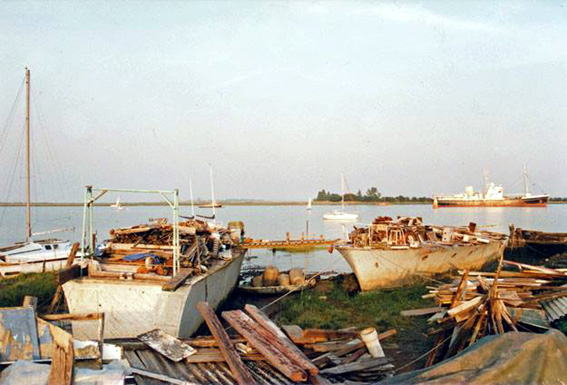
The area between Herrings Point
and the Lock entrance has for many years been used both for dumping
hulks (particularly from the canal) as well as livaboard boats
and barges. It is also the best section of the village frontage
for moorings with longer tidal access. |
 |
|
(above)
1979. |
|
 |
|
(above) 1978. |
|
 |
|
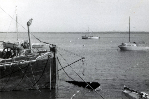
(above) 1979. |
|
 |
|
(above). 1980's |
|
|
The Lock entrance or 'Gutway'
as it was locally known, was once a fairly large fanned out area
controlled by the 'Canal Company' to enable the large working
vessels under sail to make the entrance and leave safely. Over
the yearts this area has been severely encroached on nto be just
a small area either side of the Gutway channel. From time to
time attempts with pumps etc are made to help clear it now that
there are rarely large vessels to help scrape the sediment. Small
braches known as 'Withey's' were often placed along side the
'Gutway' to mark it's position at the earliest levels of tide. |
 |
|
(above) |
|
|
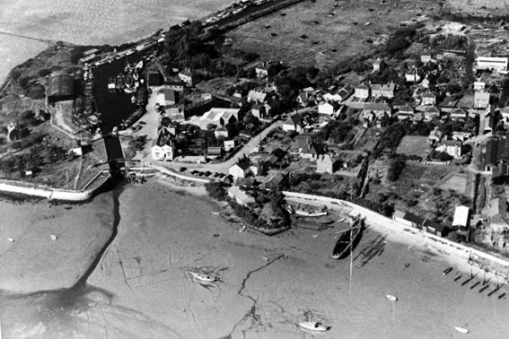
The arial view in the
picture above gives a clear idea of what the waterfront from
the 'Gutway' to the barge blocks built by 'Dilbury' Clark on
the extreme right once looked like. The picture actually covers
the complete area of the original village of Heybridge Basin
before the further developments in the mid 19th Century. The
seawall has had four major rebuilds over the last 100 years.
On the extreme left it can be seen that the new specially cast
concrete blocks set in pitch have been built into the new seawall
defence, the old rocks used for it's previos construction were
discarded by just rolling them down to the beach (the dark objects
at the base of the seawall). This practice sadly affected even
the small village beach in front of the Jolly Sailor. Moving
further along from the small beach frontage we come to the little
peninsula once known as 'Muckers Island', built on the spill
from digging out the Lock and Basin during it's construction.
In the middle foregound a dark squiggly line can be seen eminating
from just to the right of 'Muckers Island' and leading down to
the water's edge. This is the outfall from the one and only drain
out of the village. The drain can only operate when the tide
is low as it's outer doors are shut with the pressure of the
high tide. There have been times when the doors have jammed open
and it has had the opposite effect, with water flooding in to
the village at high tide. Just past the large hulk nosed up to
the beach is the remains of the original 'May & Butcher'
slipway. And finally to the old barge blocks built by 'Dilbury'
on the extreme right. In later years, the London Borough of Newham
established it's outdoor centre just past the 'M & B' slipway,
first with the barge 'Mamgu' and later replacing it with the
barge 'Haybay'. The area to both the left and right of it was
developed by 'Stebbens boatyard'. |
 |
|
(above) The London Borough
of Newham's barge 'Mamgu', and the Northern part of 'Stebbens'
Boatyard waterfront. |
|
|
Apart from a few bathing
huts and the odd moored boat, this exposed beach between Stebbens
and the Blackwater Sailing club, was fairly unused except for
the breaking of ships by 'May & Butcher', and the great many
temporary livaboard small boats, short term immediately after
WW2. |
 |
 |