|
Heybridge Basin (Cannibal
Island) |
|
|
Click
on underlined blue names for link to more details |
|
|
The Village Tour |
|
Page
Four |
|
|
|
On the other side
of 'Chapel Lane', is the old wooden Reading Room and 'Chapel'. |
 |
|
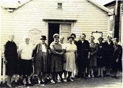
(above) a 1950's picture of a group of the ladies of the
village standing in front of the 'Chapel'. |
|
|
On reaching what is commonly
referred to as the 'car park corner', on the right side is the
entrance to the new car park developed on the land once known
as 'Daisy Meadows'. Even in it's short life there have been several
changes to the car park by the Maldon District Council in it's
wisdom. There were several attempts at placing a ticket machine
in it's centre and charging for parking, but each time it was
shall we say .... thwarted by the villagers. There was even a
toilet block erected at the entrance, but that soon met a similar
fate and was removed. On the left hand side of the corner is
the block of two cottages 'Iona' and 'Wyona'. These are all that
remain of an original block of four, after the bombing
raid in 1943 which killed several residents. The pointed
roof house of 'Rohan' on the other side of the road was actually
built in the 1920's although looking very post war and modern. |
 |
|
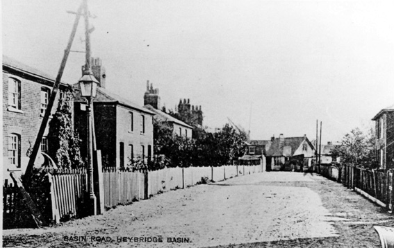
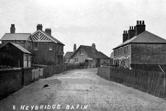
(above) looking towards the car-park corner in the 1920's,
the pointed roof house (Rohan) can be seen at the bottom, note
the road still has an unmade surface. |
|
|
An alleyway or pathway
lies next between the corner house and what was once a large
store and Post Office run by Mr Samuel
Purkiss. The alleyway or pathway has over the years been
referred to generally as 'Two Ways', to this end we will also
use that name. As 'Two Ways' leads to another complete section
of the village we will carry the description of that area over
to the next page, and carry on up to the 'Jolly
Sailor' on this page. |
 |
|
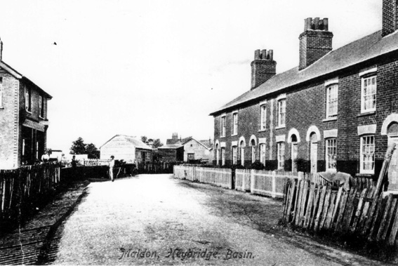
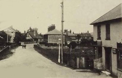
(above) from a postcard that was postmarked 1927. Looking
towards the pointed roof house by the car-park corner, from the
'Jolly Sailor' end of the road, with
Samuel Purkiss's shop on the left,
and on the right the end two cottages were also lost in the 1943
bombing raid. |
|
 |
|
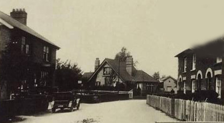
(above
and below) two more pictures looking back towards the car-park
corner, before and after the bungalow on the corner was built. |
 |
|
|
On the the left
hand corner are the two remaining cottages of a group of four
that were bombed in 1943, namely 'Iona'
on the corner and 'Wyona' next to it. 'John
Handley' operated a car hire business from this cottage.
The next place on the right noteworthy after 'Sam
Purkiss's store is the old dwelling which in recent years
has been called 'The Anchorage', built
originally for John Clark it was at one time the 'Live
& Let Live' beer house. |
 |
|
(above) From a postcard postmarked 1927. On the right
is the front of the 'Jolly Sailor'.
And out of sight to the left is 'The Anchorage'.
Picture taken before the wooden garages were built next to the
Jolly Sailor. |
|
 |
|
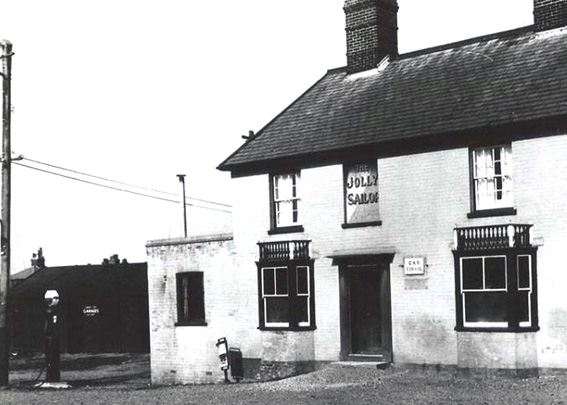
(above) The 'Jolly Sailor', when it also diversified as
a petrol station and garage, with a good view of the petrol pump
and newly constructed wooden garages behind, with the Castrol
sign on them. |
|
|
On the opposite side of
the road still heading towards the 'Jolly
Sailor', the small group of wooden garages stand that are
often wrongly described described as old stables. Behind was
an artesian well. |
|
|
Moving forward up
towards the sea-wall we come to one of the two busiest areas
of the village. On the left first the 'Jolly
Sailor', and between it and the sea-wall a small hut that
was once served as a shop. The area in front of the 'Jolly
Sailor', was grassy and often referred to as 'The Village
Green'. for many years 'Quoits' was played there. Behind the
pub was a barn. The village talking places where the men
met were by the barn behind the 'Jolly Sailor'
or the side of the 'Robins Nest' depending on the wind direction. |
|
Although for many years
the two largest pubs in the village were both on the sea-front
so to speak, it's the 'Jolly Sailor'
that the village major activities and events have always centred
around. Often organised from within the pub itself, like the
Regatta's, Royal and other celebrations,
firework displays and visiting rally's. The 'Jolly
Sailor' has mostly been used as the village pub, wheras 'The Old Ship' used mainly by visiting
ship crews and canal pleasure-boat visitors, plus the lock keepers
and family's living on Lock Hill. The 'Jolly
Sailor', also of course being the the longest standing pub
in the main part of the village, with 'The
Old Ship' being new, relatively speaking within the life
of the village. |
 |
|
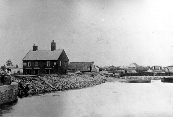
(above)
An early picture of
the 'Jolly Sailor' public house to the left, the
wooden hut that was used as a shop next to it. And finaly 'Muckers Island' with the filled in walkway from
the sea-wall to it on the right. In the distance can be seen
the buildings along the sea-wall of 'May & Butcher'. |
|
|
|
 |